Services
Driven by innovation and purpose, we strive to leave a lasting, positive impact with each of our clients through advanced drone imagery and service. From precision mapping, environmental analysis, and stunning real estate marketing, our solutions deliver the data and visuals needed to elevate every mission. Partner with us and transform the way you see the world.
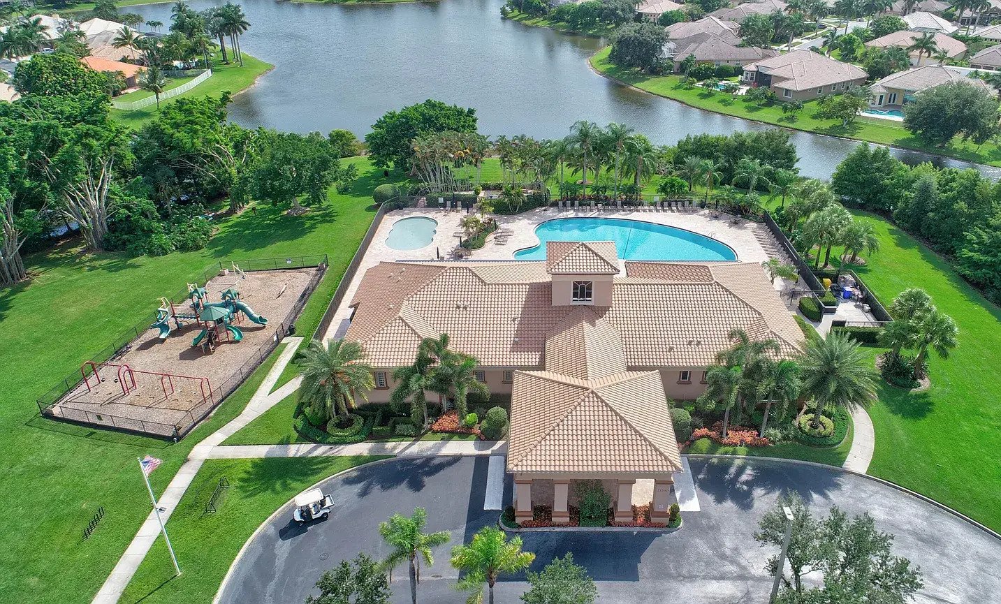
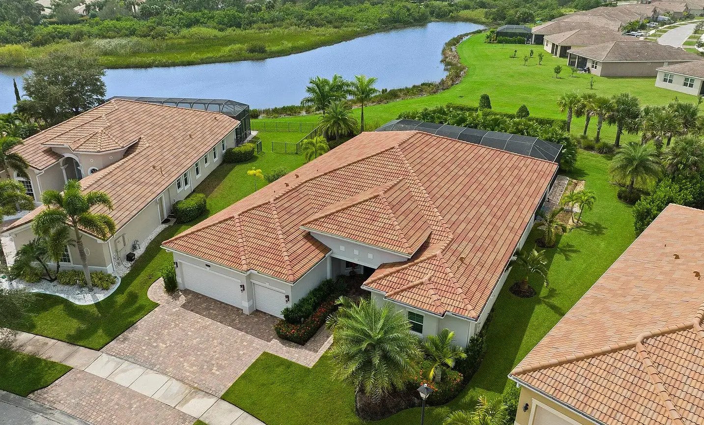
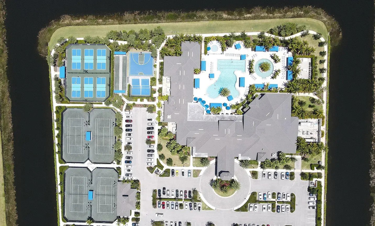
Real Estate Services
We specialize in aerial drone photography tailored for real estate professionals. Every mission is conducted with a strong focus on flight planning and safety and regulatory compliance to ensure smooth, risk-free operations. Our team captures stunning high-resolution images, then carefully edits and enhances each photo to highlight your property's best features. With a fast 24–48 hour turnaround, we deliver fully polished, MLS-ready images that help listings stand out and attract serious buyers—quickly and professionally.
- Flight
- High Resolution Images
- Image Editing
- MLS-ready Images
- 24-48 Hr turnaround
UAV Support
Sigma UAV provides full-spectrum UAV support, from strategic mission planning and airspace coordination to detailed area reconnaissance and flight execution. We ensure safe, precise operations with optimized flight paths and real-time adaptability—delivering the intel you need to complete your mission with confidence.
- Mission Planning
- Area Recon
- Flight
Data Mapping
Our data mapping services transform raw aerial imagery into precise, mission-ready assets. We process high-resolution data to create accurate maps, 3D models, and terrain analyses tailored to your objectives. Each dataset is carefully edited and refined to ensure clarity and usability—whether you're managing land or showcasing properties with MLS-ready images that meet industry standards for real estate marketing.
- Process Data
- Map Data
- Edit Images
Analytics Report
Our analytic reporting services turn complex aerial data into clear, actionable insights. We analyze and interpret key data points to uncover trends, patterns, and critical findings tailored to your mission goals. Each report is carefully compiled, edited, and refined to ensure accuracy, clarity, and relevance—empowering you to make informed decisions with confidence.
- Interpret Data
- Report Findings
- Edit Report
Additional services:
- 24Hour Support
- Around the clock support for specific missions/task
- Travel
- Domestic and International travel to any location
- Custom Service Package
- Create a custom service package specific to your needs
Elevating Real Estate with UAV Technology
June 20, 2025 by Kenny S.
At Sigma UAV, we believe in offering more than just beautiful visuals—we deliver perspective. In today’s competitive real estate market, capturing attention and building trust with potential buyers requires more than traditional photography. Our drone services provide immersive aerial footage and high-resolution imagery that showcase properties from dynamic angles, helping listings stand out and move faster. From residential homes to expansive commercial lots, our UAV technology brings every detail into focus—boosting engagement and maximizing your property's value.
But UAVs do more than enhance marketing—they transform how professionals manage and assess properties. Our drones are equipped to handle everything from roof inspections and large-acreage overviews to pre-development surveys and 3D mapping. For realtors, developers, and property managers, this means safer inspections, quicker turnaround, and better-informed decisions. Whether it’s monitoring construction progress or capturing footage for virtual tours, Sigma UAV makes it possible to see the full picture—literally and strategically.
As the real estate industry evolves, so does our technology. Sigma UAV offers bundled solutions that combine aerial imagery, interior photography, virtual walkthroughs, and advanced analytics—making us your full-spectrum partner in real estate media and property intelligence. With a commitment to precision, creativity, and reliability, we help you elevate every listing and tell a story that sells. Let us help you rise above the noise—because at Sigma UAV, clarity starts from above.
Cutting-Edge Drone Solutions for the Environment and Agriculture
January 15, 2025 by Kenny S.
Drones are revolutionizing how we address pressing environmental challenges, particularly in managing and preventing forest scrub and bush fires. These advanced tools provide real-time aerial surveillance, enabling authorities to detect overgrown vegetation, assess fire-prone areas, and monitor wildfires with unparalleled accuracy. By mapping large, inaccessible regions quickly, drones help identify potential risks before they escalate, facilitating proactive measures such as controlled burns or targeted vegetation clearing. This approach not only reduces the likelihood of catastrophic fires but also minimizes resource waste and enhances the safety of personnel.
Beyond fire prevention, drones are also making significant strides in agriculture and disaster response. For farmers, drones deliver precise data on soil health, crop conditions, and irrigation needs, allowing for smarter resource allocation and improved yields. Meanwhile, in natural disasters, drones act as critical tools for assessing damage, locating survivors, and guiding rescue efforts in areas traditional methods can’t reach. Their ability to capture high-resolution imagery and provide actionable insights makes them invaluable in fostering sustainable environmental practices and aiding communities in crisis. With drones leading the charge, industries are empowered to act responsibly and efficiently, paving the way for a safer, more sustainable future.
Wildfires in Focus: The Economic and Environmental Toll in California and Hawaii
The table below highlights the devastating impact of fires in California and Hawaii, detailing the number of incidents, areas affected, and the estimated cost of damages. This comparison underscores the financial and environmental toll of wildfires, emphasizing the urgent need for proactive fire management strategies.
| Event |
Location |
Cost |
| Palisades Fire |
Los Angeles, CA |
$57B |
| Lahaina Fire |
Maui, HI |
$12B |
| August Fire Complex |
Northern CA |
$319M |
| Totals |
|
$69.3B |
The Role of Drones in Combating Natural Disasters and Boosting Agriculture
December 28, 2024 by Kenny S.
Drones are revolutionizing how we approach environmental challenges by offering unmatched efficiency and precision across various sectors. In forest administration, drones provide real-time mapping and monitoring of tree health, illegal logging, and biodiversity. In agriculture, they enable precision farming by analyzing soil health, tracking crop growth, and optimizing resource use. For glacier movement, drones capture high-resolution imagery, helping scientists track melting rates and assess the impacts of climate change. In fire control, drones are invaluable for early detection of hotspots, monitoring active fires, and aiding in post-fire recovery efforts. Additionally, during natural disasters, drones play a critical role in assessing damage, locating survivors, and delivering emergency supplies to hard-to-reach areas. Together, these applications showcase how drones are vital tools for sustainable development and disaster resilience.